Trip #45 - Algonquin Park Summer 2020
North Tea Lake
This summer Grant and I embarked on one of the greatest Algonquin trips we have yet experienced.
Our story begins as all great stories do: Two brothers, enjoying a couple beers the eve before a trip as they sit in the light of the Westering sun while looking onto a car packed with gear and topped with a fully-secured canoe - all ready to go to parts unknown. It's moments like this, on the night before leaving for a trip, when you can count the hours till your early rise and wonder, "Heck, why not just leave right now? We can sleep in the car!". We decide we need a better rest than that could offer and I yell to Grant as he walks away, "See you at 3:00!"
Wednesday August 19, 2020
5:14 PM
North Tea Lake
Island site. Near end of the lake. The one with 2 sites on it.
I awoke at 2:40AM, quickly left the house and was at Grant's before 3:00. he was up and waiting for me at the road. There isn't much to say about a drive up to Algonquin at this time, other than to point out it is the only time to go. A smooth sail before any of the traffic the GTA is known for is even up and moving.
We arrived at a packed parking lot at 7:45AM. Luckily we were the only people at the permit office at this time and all of the parked cars were simply indicative of the other campers who were already in the park over the previous days. We unpacked at the put-in, parked the car in one of the few available spots, and were on the water by 8:00AM. Kawawaymog (Round) Lake was calm and it was an easy paddle across the shallow lake. The lake was so shallow in fact, that we never reached a point on the lake where we could not easily see the bottom beneath us.
Crossing Kawawaymog Lake:

Once across Kawawaymog Lake we entered the meandering start of Amable du Fond River. The first few hundred meters of the Amable du Fond consists of many twists and turns; some of which have you seemingly backtracking as you progress.
Amable du Fond River:

Once you pass the river fork (turn right at the fork), you soon find yourself in a wide river that flows more or less straight until you reach the West Arm of North Tea Lake. Two very short portages separate you from North Tea, and as we arrived at the first of such we found the portage occupied by trippers leaving the put-in.
This was the perfect opportunity to bring out the burly pipe and have a bowl of the old Captain Black White. A few minutes of blowing smoke rings and the portage was free and clear for our passing. We took this and the next portage in stride and soon found ourselves approaching our main goal: the grand and majestic North Tea Lake.
We arrived at the West Arm of North Tea at 10:30AM. If you are keeping track you will note that the journey from the put-in thus far has taken us 2.5 hours. Over many years of tripping I have come to discover that I am most fond of the larger lakes of this category, North Tea may be one of the best. The lake greets you instantly with a wide, long expanse of open water, dotted here and there with lonely islands that call to the camper who yearns for seclusion. North Tea Lake demands a map. One quickly finds that a pair of binoculars come in quite handy as well, especially in the busy season such as we found ourselves in, where finding just a few open sites can be quite the challenge. The ability to see kilometres across the lake was vital to avoid travelling mindlessly around searching for sites.
As it were, we were not staying on the West Arm this night. In fact, we were to spend the first two night of our trip on the East Arm, and them backtrack to the West Arm for our final night. That fact did not prevent us however from checking out the sites we passed so that we could get a preview of the sites we could be choosing from when we were to return to this arm on our final night. The West Arm of North Tea Lake is populated with many islands. Many of which have multiple sites on them, but at least two that have only a single site. (my personal favourite). The first island we came to is the small solitary island that rests almost in the middle of the lake. Had we been staying on this arm of the lake for our fist night this may have been the site we would take, for as luck would have it, the occupants were just leaving it as we passed. We had much more to see on this lake, so we continued on towards the East Arm, passing many nice sites and a good cluster of islands along the way.
After about an hour we reached the East arm. Rounding the last corner by the narrows you are greeted with another large expanse of water with a beautiful island in front of you. This island has a large stone cliff face which positions the site well above the lake itself. This island was occupied so we moved on further into the arm of the lake. What we soon discovered is that in contrast to the West Arm, the East Arm of the lake at this time was quite occupied with campers. As we passed site after site we found them all filled. All of the island sites appeared taken, and most of the ones we could see along the shoreline were occupied as well. At this point we decided to travel to the far end of the lake and try for the last small island, which showed as containing two sites according to the map. As we approached the end of the lake we saw that the North-most site on the island was clearly occupied, and it also appeared that the Southern site was as well. To the Eastern shore was a single open site and we decided that we had better take it or else be stuck looking for a site for quite a while along this long lake. We made our way to the shore site.
As Grant emptied the canoe I took a watch on the island that we had been hoping to get. It appeared that the people on the Southern site were just swimming, as I could see no tents. Sure enough, Grant had no sooner emptied the gear onto the shore site when the people on the island got into their canoes and left. At this time the wind was coming off the lake and we decided that the island site would offer us better protection from the West wind. We decided to get over there as quickly as possible and try to secure that last island site. Deciding to leave a site for another one on a busy lake is a risky proposition. No sooner can you pack up and leave than find you have someone else racing to take the same site as you. We hauled ass over to that island as quickly as we could and claimed it just in time. With the amount of canoes on the lake that day looking for good sites, its really just a matter of good timing a luck to get what you want.
We finally had a place to call home for the night and, after packing, had time to relax and explore the island a bit. Though the island was small and had two sites on it, each site was at an opposite side of the island and the middle of the island rose between them like a small cliff, providing more than enough seclusion between the sites.
The best feature of our site was this granite point that jutted out into the lake facing South:

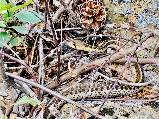
This little guy shared the rock point with us:
Being on an island site typically means travelling to the mainland for fire wood; so Grant and I hopped into the canoe and began to paddle the shore looking for a good place to stock up on fuel for the fire. We soon spotted and sandy shore not far from our island and made our way to the beach. This turned out to be a great place to stock up on firewood as the beach was strewn with dozens of fair size dry driftwood pieces. We soon had the canoe full of driftwood of all sizes and made our way back to our island. This was enough wood for two days, which was our intended stay on this site fore moving onto the West Arm for our third and final night. It turns out is was more wood than we needed, as you will see a little later.
Sometime after dinner Grant headed out in the canoe to fish and I decided to cook up the only fresh meat I took in with me: a package of thick-cut bacon. I failed to bring a proper fry pan, so ended up frying this whole pack in my small stainless cook pot. The stainless was so black and tarnished once I was done I thought it would never come clean again. (I was wrong as it turned out - sand is a great cleaner). I had just finished my 5th slice of bacon when I could hear Grant excitedly calling for me to come over with my camera. Apparently he had caught a fish.
What a fish it was. A bass, 18" in length and quite a few pounds in weight. Timing was such that we both had full bellies, so he let it go, but not before we snapped a few photos:

Believe it or not, just 5 minutes later and he was calling me again. he caught another bass of almost equal size.
He let the second fish go as well, and although I am not much of a fisherman, I couldn't help but grab my rod and hop into the canoe to fish as well.
I only caught a single fish - this lonely perch (let it go as well):

We had a great fire that first night, burning through most of the driftwood we had acquired on the beach. I setup my small radio to try and catch the weather. The forecast had not been 100% great before we left, and although this first day had been warm and sunny, I was sure there might be some rain coming. I found two CBC Radio stations that gave us the weather at a regular hourly interval (5 mins pas the hour). I sounded like we may get some rain over the next 24 hours or so. It had been a long day, so after a while at the fire Grant turned in sometime after 9:00 as I stayed up just a while longer to get a good look at the stars from the rock point. I had no tarp setup over my tent, as I had found the fly was quite thick and waterproof on its own (it the Eureka El Capitan 2), so I tucked my gear into my vestibule, zipped the fly closed, and went to sleep with a podcast playing in my ears.

The next morning I woke to rain playing a rhythm on my tent. Climbing out I found our island cloaked in fog. Grant and I had our breakfast, setup a tarp to sit under, and started thinking about what we were going to do on this rainy overcast day. I put on the radio under the tarp, we each grabbed out maps and started to plan a short adventure to walk the the 2200m portage to Manitou Lake. It was at this point that I discovered that I failed to pack any rain jacket or poncho at all. I had believed that I packed a single poncho, but apparently I was mistaken. All I had was a stuffed MEC jacket, so I pulled that on and we set out to the portage.
The main feature of this portage is a large waterfall at the head of the river connecting North Tea to Manitou. There is actually a campsite right off the path of the portage here, and just a few meters from the actual waterfalls. Whoever camps here would have the falls to explore all day, and also the roar of the falls drowning out all other sounds the entire time. As it were, the site was occupied so although we were able to approach the fall from the side, we never got a chance to get to the main waterfall; its just too close to the site and we aren’t the types to trapes through another s campsite.

Returning back to our island later that day we found that the wind from the South West had picked up quite a bit and it was clear that we were very exposed on our island site. These conditions made it impossible to think about starting a fire, and even sitting under the tarp was impossible as the winds were just too strong. The wind was so strong that we saw at least one canoe get wind-bound on the shore of the lake for a few hours to wait out the headwind. After a while of bearing the wind we decided it was time to look around the lake for another site. One that would give us shelter from the wind. It continued to rain all day, so the regular features we would look for in a site were not needed - just shelter from the wind. I scanned the lake with my binoculars and we spotted a dark little site on the Western shore, only about a kilometre away. Although we saw a few other canoes on the lake still we thought our chances were good if we packed up quickly and made our way to the site before it could be taken.
The trek across the site was into the wind. I found myself splashed with water several times as whitecaps crashed over the bow. We paddled as had into the headwind as we could, and were happy to find the site empty as we approached the little sheltered bay it was in. The site had a nice sandy beach out front, but aside from that nice feature it was an otherwise poor site for any occasion but getting out of the wind. The site was a dark and tree-covered site which backed right up to the thick woods behind it. It was the kind of site that stayed in the shadows most of the day and saw little sun; but as there was no sun in the sky to be seen, this particular day was perfect for such a sheltered site. I set up on the sand by the lake and Grant setup deeper back on a mossy pad. Afterwords I was able to wade out into the sandy waters and have my first swim of the trip.
There is not much else to tell about this second day. Once out of the wind we gathered lots of firewood and had a night by the fire, only occasionally broken up by rain showers. We called it a night early with anticipation for the next day where we would be leaving the East Arm and finding a site on the West Arm for our last night.


Friday, August 20
1:27 PM
We awoke at 7:00 AM to a fog-covered lake. We had decided the previous night that we wanted to get up and get on the water early to avoid any wind that may arise later in the day. By 8:15 AM we were all ready on the water and on our way to our next site. As we paddled out of the East Arm the clouds overhead began to break up and patches of blue sky began to open up. By the time we made it to the narrows which separated both arms of the lake, the sky had become what Grant called “Simpson’s clouds”; nice blue sky and sunshine only blocked by intermittent white puffy clouds. Weather-wise, it was becoming a perfect day.
Entering the West Arm we began to methodically check each site we passed to see if it was available and possessive of the qualities we were looking for. For a hot summer day, we wanted a site with a good view of the sun, as well as a nice place to swim. It was clear however, that finding just an open site would be a challenge, as this lake was quite full. All of the first several sites we passed were occupied. This still being early in the day, it was impossible to know if any particular site would open up later in the day or not. We decided to try for the nice island sites we passed on our way in two days before. We found one of these sites was indeed open; it was a smaller island with two sites on it. One facing South was the nicer of the two but was occupied, the one on the North open. We decided that we wanted to try further into the lake - the day was young and we still had lots of unchecked sited ahead of us.
In the middle of the West arm of North Tea there is a large island that has several sites on it. As we paddled past we noted that none of them seemed to be spectacular sites. As the sun rose higher in the sky and the temps began to rise, we decided we would not settle for just and old site today. We were out to find a spectacular one.
Once on the open lake we spotted the lonely island in the middle of the lake and made our way towards it. This was the site on my mind after passing it on the way in three days earlier. As we came near it we discovered that it was however occupied. At this point in the lake I could see almost all of the way across the lake with my binoculars so I began to scan the shore for open sites. To our surprise and slight dismay, it appeared that practically all of the other sites were occupied. We briefly discussed going back to the small island we had passed earlier, but Grant wanted to try for the last small island on the lake, tucked in close to the Southern shore of the arm. From our vantage point we could still not see if any of its two sites were occupied, but decided to push on as the sun rose even higher in the sky above.
Rounding the last bend we came upon the island which was our destination. It had a beautiful high rock protrusion jutting northwards towards us into the lake. It was what we like to call a “gaga site” - a site with such great features that you just want to explore it. Unfortunelayit was also occupied. Things were looking a little grim now, but we had one last hope - the other side of the island held a second site; we had not seen it yet but assumed it was occupied given the traffic on the lake these past few days, and the shortage of island sites. We paddled onward, but did not hold mush hope.
Upon reaching the far side we saw a site unlike any others I had seen in the park before. The site sat upon a high rocky shelf above the take-out. Between which there was a very steep slope of rock climbing 20 feet or more in height. To the end of the island jutted a granite point of roughly 75 feet in length, which tapered to a fine point at the very end of the island. From our low vantage point we could not tell of the site was taken, but we saw no sight of canoe or tent. We quickly got out of the canoe and made our way up to the top level of the site to see if it could possibly be available. To our utter surprise it was vacant. Grant and I couldn’t believe it; we got our wish - we were spending our last night on a Gaga site!

The next day we packed up and started the long meandering paddle home. What a great trip this was!


